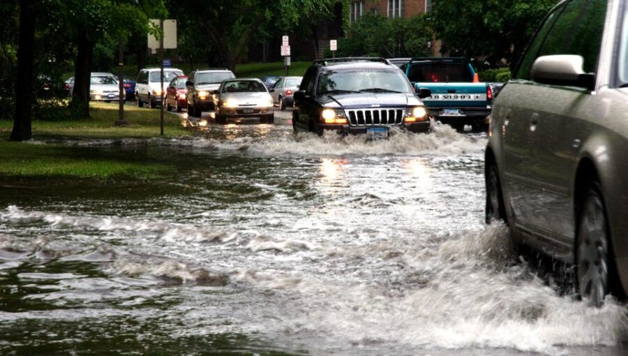
With flash flooding of basements posing a threat to life, the subsidence insurance bill for 2022 set to be US$273 million and the European windstorms of last year costing $4,191 million, it has become imperative for insurance providers to make a full, fast and accurate assessment of environmental risk, from quote to claim.
LexisNexis Risk Solutions harnesses data and advanced analytics to provide insights that help businesses and governmental entities reduce risk and improve decisions to benefit people around the globe. The company provides data and technology solutions for a wide range of industries including insurance, financial services, healthcare and government.
According to reports, the LexisNexis Basements Indicator, Bluesky International Ltd’s National Tree Mapping (NTM), and LexisNexis Windstorm Model add to a wide range of existing data solutions to provide insurance providers with a holistic view of property risk for pricing and underwriting. The solutions help identify customers at most risk from imminent or future basement flooding, as well as tree- and wind-related storm damage and subsidence.
Three new geospatial data sets from LexisNexis Risk Solutions that can benefit insurance providers:
- Basements: LexisNexis Basements Indicator combines multiple data sources to create a unique attribute that helps property insurance providers identify whether a basement or an underground level may be present in a home or a commercial building.
- Trees: Bluesky’s National Tree Mapping (NTM) is the first-ever detailed national map of the hundreds of millions of trees across Great Britain and the Republic of Ireland. Through LexisNexis Risk Solutions, insurance providers can now understand the location, canopy cover and height of trees 3 metres and taller in the proximity of the properties they are insuring.
- Windstorms: LexisNexis® Windstorm Model is a new solution that helps to predict the maximum wind gust speeds as a better predictor for property and structural damage compared to sustained wind speeds. The Windstorm Model will help home insurance, commercial insurance and motor insurance providers to more accurately assess the level of risk to a property or a vehicle across the U.K., either in map form using the geospatial data visualisation tool LexisNexis® Map View, or as data enrichment at the point of quote.
Flash flooding is becoming a regular occurrence in urban, high-density areas such as London due to the reduced permeability of surfaces (paved drives for example), clay soils and ageing drainage and sewage systemsvii. Indeed, in Summer of 2022, The Mayor of London urged 45,000 residents living in basement homes to take greater measures to protect themselves and their homes in a flood. In addition, ‘mega basements’ with high value possessions could pose an additional risk to insurance providersix in flash floods and where long spells of rain cause groundwater floodingx with water seeping into cellars or basements.
Caroline Elliott-Grey, product manager, U.K. and Ireland, for LexisNexis Risk Solutions said: “Property insurance providers need to plan how they will map the long-term impact of climate change on their books of business. They can start now with LexisNexis Basement Indicator, NTM and LexisNexis Windstorm Model together with more than 40 additional data sets, including perils data down to an individual address. We are making it as easy as possible for insurance providers to access this data at point of quote via LexisNexis Informed Quotes and for more detailed risk visualisation through LexisNexis Map View – our cloud-based geospatial data visualisation tool.
More data means more granularity and spatial accuracy in the predictions, allowing for more accurate pricing, as well as the crucial ability to better manage risk as events unfold.”Related Climate Risks – Key Facts:
- Global warming could raise the U.K. flood damage bill by 20%
- 1 in 6 homes are at risk of floodxii
- Flood claims where drains were unable to cope increased by 211% in the last four years, according to LV
- Basement flood risk is increasing particularly in London, where 7,328 basements were approved in London between 2008 and 2019
- Subsidence prone areas are set to double by 2050
- The ABI confirmed that last summer’s heatwave led to 18,000 subsidence claims equating to a new claim every 15 minutes during the second half of 2022.
- Although subsidence claims are rising as temperatures rise, trees are also implicated in 70% of reports of subsidence and heave on clay soil, making knowledge of their location and height vital with subsidence claims on the increase.
- Climate change will also drive an increase in windstorm activity over the U.K. with increased frequency already being seen in recent years. The ABI estimates that future insured losses are expected to increase by 18% within the next 100 years.
Source: LexisNexis Risk Solutions